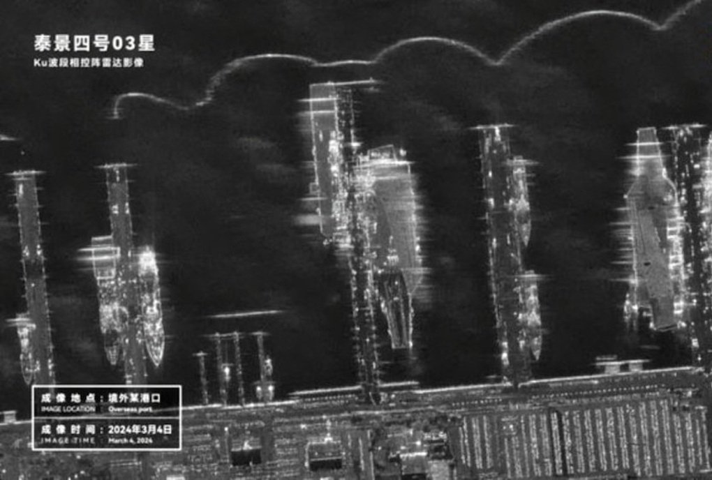
(Dan Tri) – China’s Taijing-4 03 satellite using artificial intelligence (AI) can take detailed images of a US aircraft carrier, showing it has advanced surveillance and targeting capabilities.
Chinese satellites took pictures of Washington’s warships at strategic bases on US territory (Photo: National Interest).
China’s Taijing-4 03 satellite recently captured detailed images of the US Navy’s strategic Norfolk naval base, revealing Beijing’s advanced space-based intelligence technology.
The photo posted by National Interest shows that Chinese satellites captured 3 US aircraft carriers, 2 Arleigh Burke-class warships and 4 unidentified ships.
National Interest notes that Taijing-4 03 is believed to be privately produced and is one-fifth of a satellite nominally used for scientific research and environmental surveys.
It is equipped with synthetic aperture radar (SAR) and AI processor to quickly detect and identify targets at sea and at airports and transmit images in real time.
China has previously used AI to significantly enhance the capabilities of commercial satellites, allowing them to become powerful intelligence, surveillance and reconnaissance (ISR) systems.
In April 2022, Asia Times reported that China had equipped its commercial satellite Jilin-1 with AI, allowing it to act as a powerful reconnaissance platform, achieving a 95% accuracy rate in identifying
Today’s AI can track moving objects even when they make sharp turns or disappear into tunnels, overcoming the weaknesses of previous technology.
In May 2022, SCMP reported that a Chinese AI satellite detected and tracked the aircraft carrier USS Harry S Truman during an exercise off the coast of Long Island, New York, providing Beijing
SCMP noted that the satellite’s AI can process high-resolution images quickly, identifying military weapons with minimal calculation.
Expert Mike Fredenburg said that China can now scan large sea areas to automatically detect and identify ships, provide real-time targeting data for weapon systems and significantly improve
He noted that although the US has more satellites in orbit than China, US satellites are generally older and many are nearing the end of their useful lives.
Experts warn that China’s ability to track and target more effectively could further limit the ability of US aircraft carriers to operate in the oceans in the future.
